How San Antonio Embraces Tech for Easy Travel
San Antonio is steadily transforming how visitors and residents move around the city through coordinated smart city initiatives and transportation technology. Through the SmartSA partnership, multiple public agencies collaborate to improve mobility, data sharing, and infrastructure. From real-time transit tools to pilot programs in autonomous mobility, these efforts aim to make travel across San Antonio more efficient and accessible.
The SmartSA Partnership: Collaborative Data for Smarter Mobility
Since 2018, San Antonio has brought together nine public and academic partners under the SmartSA initiative, including CPS Energy, VIA Metropolitan Transit, San Antonio Water System, and the University of Texas at San Antonio (UTSA).
This collaboration is formalized through an Interlocal Data Sharing Agreement, allowing agencies to securely share information and coordinate projects that improve transportation, infrastructure, and public services.
Through this partnership, agencies meet regularly to identify opportunities where shared data can improve traffic flow, transit reliability, and safety outcomes, including projects focused on analyzing crash data and optimizing intersections.
Innovation Zones Testing Transportation Technology
To pilot new technologies before citywide rollout, San Antonio established three designated innovation zones:
- Brooks City Base (southeast San Antonio)
- South Texas Medical Center (northwest San Antonio)
- Downtown San Antonio
These zones were selected for their infrastructure and ability to test different mobility challenges. Pilot programs have included autonomous shuttle trials, smart traffic detection systems, and connected infrastructure designed to improve pedestrian and vehicle safety.
Brooks City Base, in particular, has hosted autonomous vehicle demonstrations and mobility pilots in partnership with private companies and research institutions.
Getting Around Key San Antonio Neighborhoods
Each major area in San Antonio offers a different travel experience depending on your location.
- Downtown:
The most transit-friendly area, with access to VIA buses, bike shares, and walkable attractions like the River Walk and The Alamo. Digital kiosks and real-time transit tools are most concentrated here. - Pearl District:
Located just north of Downtown, the Pearl is accessible via bus routes, rideshare, or bike trails. Many visitors use apps to navigate between Pearl’s restaurants, boutiques, and the San Antonio River. - South Texas Medical Center:
A more spread-out area where rideshare or rental cars are often more practical, though VIA routes still serve major facilities.
Understanding these differences helps you plan your day more efficiently and avoid unnecessary travel time.
Digital Kiosks and Real-Time Transit Information
At key transit hubs such as Centro Plaza, San Antonio has introduced interactive digital kiosks that provide real-time travel information.
These kiosks offer:
- Live bus arrival updates
- Multi-modal route planning (bus, bike, rideshare)
- Nearby attractions and wayfinding tools
- Event and city alerts
The kiosks are part of the IKE Smart City platform, which also supports advertising revenue to help offset operational costs. Users can transfer directions directly to their smartphones, making it easier to navigate the city without relying solely on printed schedules.
How Visitors Use San Antonio’s Smart Travel Tools in a Single Day
A typical visitor can rely on San Antonio’s connected systems from the moment they arrive.
You might begin your morning at Centro Plaza, using a digital kiosk to check real-time bus arrivals and map a route to the Historic Market Square or The Alamo. Directions can be sent directly to your phone, allowing you to continue navigating without returning to the kiosk.
From there, transit apps like Transit or Google Maps provide live updates as you travel between Downtown attractions. If plans change, the same apps allow quick rerouting to destinations like the Pearl District, where you can explore shops, restaurants, and riverfront spaces.
By evening, you can compare transit options with rideshare apps to return to your hotel efficiently, using real-time data to avoid delays. This combination of kiosks, apps, and integrated data makes it possible to navigate the city without relying entirely on a car.
Smart Streetlights and Connected Infrastructure
San Antonio has piloted smart streetlight technology in its innovation zones, integrating sensors into lighting systems to improve efficiency and data collection.
These smart systems can:
- Monitor air quality and temperature trends
- Detect outages and notify maintenance teams automatically
- Improve energy efficiency through LED upgrades and remote management
While parking detection is still limited in scope, the broader goal is to build a connected infrastructure network that supports safer and more efficient travel.
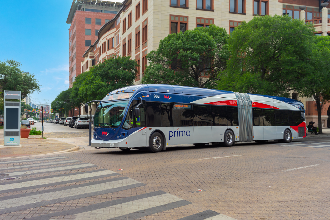
How VIA Metropolitan Transit Connects to Your Phone
San Antonio’s public transit system, VIA Metropolitan Transit, provides extensive digital tools that make navigating the city easier for visitors.
You can access transit information through:
- Google Maps and Apple Maps for route planning
- Apps like Transit, Moovit, and TripGo for real-time updates
- VIA’s goMobile+ app for mobile ticketing and fare purchases
These platforms offer real-time bus tracking, trip planning across multiple transportation modes, and digital ticket storage. Riders can also view accessibility updates and service alerts directly from their devices.
Rideshare vs Transit vs Rental Car: What to Choose
San Antonio offers several transportation options, each suited to different travel styles.
- Public Transit (VIA Metropolitan Transit):
Best for budget-conscious travelers staying near Downtown or major corridors. Bus fares are typically around $1.30 per ride, with day passes available for about $2.75, making it the most affordable option. - Rideshare (Uber, Lyft):
Ideal for convenience and shorter trips. Expect fares around $8–$15 for short Downtown trips and $20–$35 for longer cross-city rides, depending on demand and time of day. - Rental Cars:
Recommended for visitors planning to explore beyond central neighborhoods. Daily rentals typically range from $40–$80, with parking costs varying by location.
For most visitors, combining transit during the day with rideshare in the evening offers a balance of cost efficiency and convenience.
Open Data Tools for Travel Planning
San Antonio’s Open Data Portal provides publicly accessible datasets and mapping tools that support smarter travel planning.
Visitors and planners can explore:
- Transit routes and schedules
- Traffic and infrastructure data
- Interactive maps for walking, biking, and driving routes
These tools help power third-party apps and improve transparency, allowing travelers to better understand how to move efficiently across the city.
EV Charging and Emerging Smart Infrastructure
San Antonio continues expanding its electric vehicle (EV) charging network, with hundreds of public charging ports available across the metro area. CPS Energy operates several stations, and private partnerships are increasing access at grocery stores, retail centers, and universities.
Future-focused infrastructure efforts include:
- Expansion of fast-charging stations
- Continued integration of smart grid technology
- Development of flood monitoring systems to improve safety during severe weather
These investments support a more resilient and forward-looking transportation system for both residents and visitors.